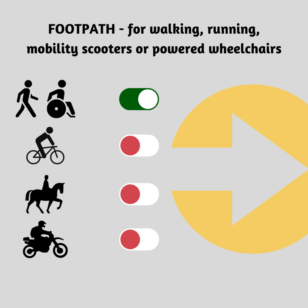
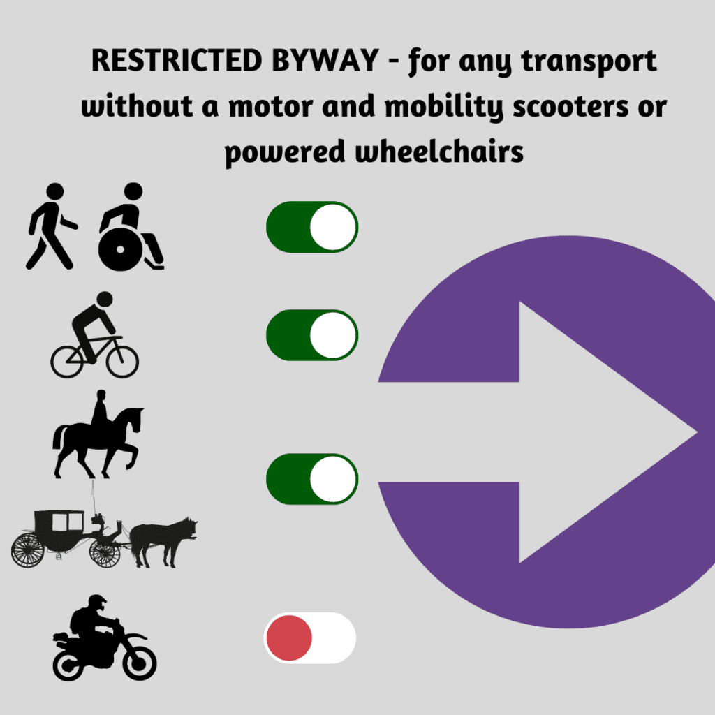
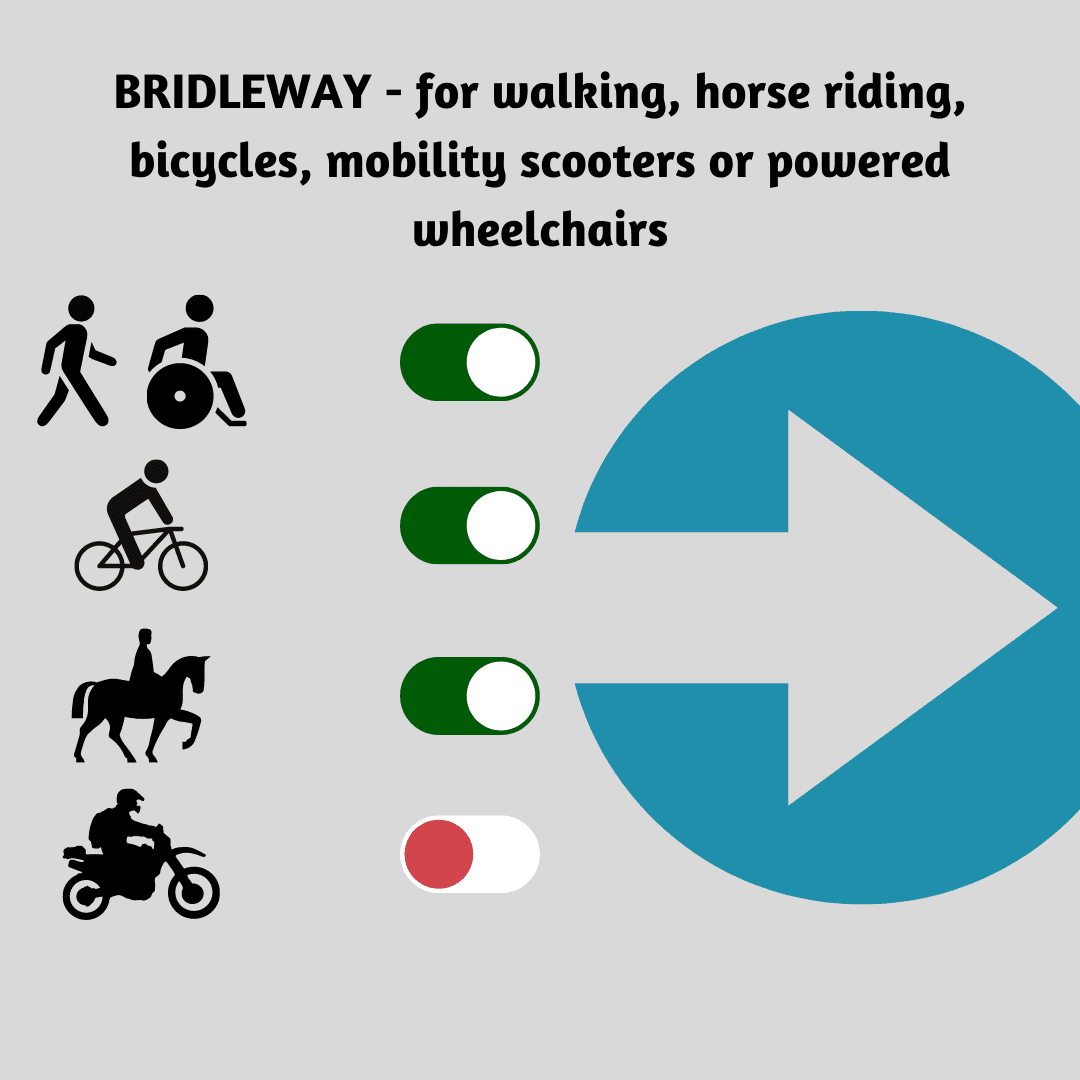
What You Can Do On Public Rights of Way
Know Your Public Rights Of Way
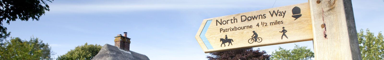
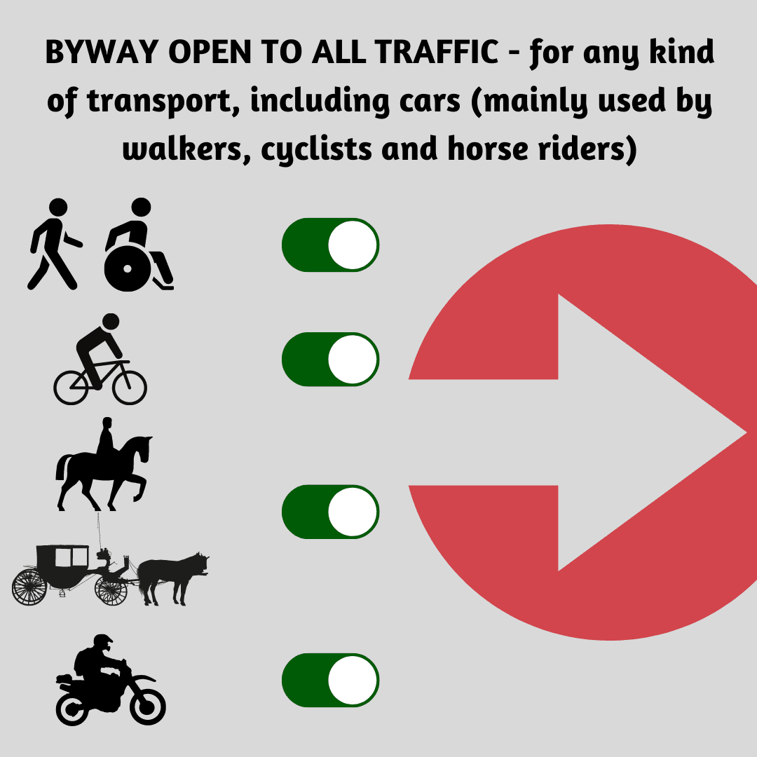
A day out in the countryside should be a pleasurable experience however, it can become confusing when being confronted by different signs along the way. This is especially true if you are riding a bike or horse as it can become unclear which routes you should be using.
Check out our guide to signage and clear the confusion and make sure that signage confusion doesn’t put a dampener on your day out.
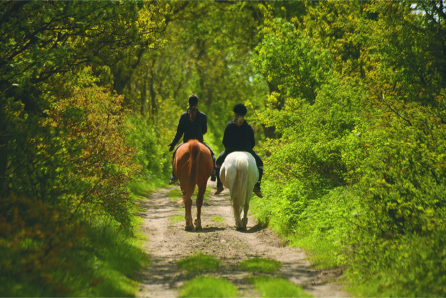
Remember! Bridleways are used by horses and bikes which gives us all the added benefit that there will be no stiles along these paths. Perfect for dog walkers not wanting to struggling lifting their labrador over stiles or for those wanting a wider and sometimes more surfaced path.


Other Public Rights Of Ways
You can access some land across England without having to use paths – this land is known as ‘open access land’ or ‘access land’.
Access land includes mountains, moors, heaths and downs that are privately owned. It also includes common land registered with the local council and some land around the England Coast Path.
Your right to access this land is called the ‘right to roam’, or ‘freedom to roam’.
Public Rights Of Way Map
One of the best ways to explore and enjoy Public Rights of Way near you to find new routes is to check out the map over on the KCC website.
The map allows you to search by town, postcode and then by footpath, bridleways, restricted byways, byways and promoted routes to take.
You’ll be amazed at what you might find, new routes you may discover and unearth just how vast and well developed our network is here in Kent.
Report A Problem On A Public Right Of Way
You can report non-urgent issues along any pathway online including:
- broken stiles
- overgrown vegetation or fallen trees
- damaged or dangerous path surfaces
- damaged or missing signposts.
Please submit a separate report for each individual problem. This helps officers to identify and inspect the correct location and update you on progress more accurately.
Improving Our Rights Of Way
Want to know more about how our Public Rights Of Ways are constantly being improved and designed for our enjoyment?
The Kent Rights of Way Improvement Plan is designed to do just this, the plan supports the delivery of projects that contribute to positive health outcomes, rural businesses, the local economy and that help to reduce congestion.
Plans and schemes include making use of existing public rights of way, diverting and upgrading them to encourage and support higher levels of use. Creating benefits such as:
- provide safe and attractive direct routes between residential, workplace and education locations
- open up leisure routes in historically important areas
- reduce car journeys and therefore CO2 emissions
- improve and maintain the local environment
- free up road space and improve journey times for everyone
- support the growth in housing and jobs.