Scenic Green Trail
Please note this is not a KCC promoted route. For any queries please contact explorekent@kent.gov.uk and we will forward on to the relevant person. It’s simple to follow the trail on your smart phone, download the Kent Connected app from the Apple Store or Google Play Store.
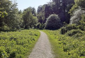
The Scenic Green Trail is a long-distance walking route around the Borough of Maidstone, created by local resident Phil Riches. It follows public footpaths and short road sections to connect nature reserves, green spaces, and historic villages. The trail showcases diverse landscapes including woodlands, meadows, orchards, rivers, and lakes, as well as charming villages with rich architecture.
The route is divided into seven manageable sections and includes practical information such as accommodation, pubs, shops, rest stops, and public transport links. Walkers are reminded to respect private land, stay on paths, and avoid littering or camping. The best time to walk is from mid-March to the end of October.
Enjoy the journey, support local businesses, and make lasting memories!
Section 1: West Malling to Wateringbury (4 miles / 6.4km)
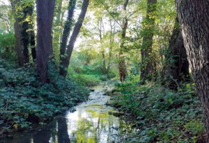
The trail begins at Manor Park Country Park in West Malling, following the Ewell stream past Douces Manor and near the medieval St Leonard’s Tower. After crossing the A228, it continues through open countryside past Broadwater Farm and along Well Street. The route passes Warren Woods, Kings Hill Football Club, and descends through woodland and orchards. After crossing the A26, it follows Love Lane and a rural footpath, ending at the historic Wateringbury Railway Station. Along the way, walkers can enjoy cafés, pubs, and local shops.
Section 1 – West Malling to Wateringbury
Section 2: Wateringbury to Tovil (5 miles / 8km)
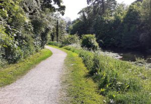
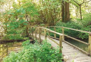
Beginning at Wateringbury Station, the route follows the scenic Medway Valley Walk along the River Medway, passing marinas, WWII pillboxes, and the historic Teston Bridge and Lock. It continues alongside the river and railway, crossing streams and reaching East Farleigh, home to a 12th-century church and a 14th-century Civil War-era bridge. The trail then passes houseboats and woodland before entering Tovil via Tovil Bridge, ending at Tovil Hill. Along the way, there are several pubs, shops, and riverside landmarks.
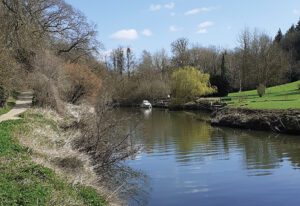
Section 2 – Wateringbury to Tovil
Section 3: Tovil to Boughton Monchelsea (5.5 miles / 8.8km)
Starting at Tovil Hill, the trail climbs through Hayle Park Nature Reserve and continues into the historic village of Loose, known for its ancient yew tree and 17th-century pub. It winds through orchards and farmland along public footpaths and the Greensands Way, descending into Linton with its scenic views and historic buildings. The route then passes through more orchards to Church Hill, near St Peter’s Church and Loddington Farm Shop, before skirting Boughton Place and ending near Robson Chase in Lyewood. Along the way, there are several charming pubs, cafés, and local shops.
Section 3 – Tovil to Boughton Monchelsea
Section 4: Boughton Monchelsea to Mote Park (7.5 miles / 12km)
Starting at The Albion Inn, this scenic trail winds through woodlands and parks including The Quarries, Stream Shaw, and Langley Park, passing Langley Loch and crossing Sutton Road. It continues past historic sites like Otham Manor and WWII relics in East Wood, with optional detours to Stoneacre and St Nicholas Church. The route follows the Len Valley Walk through lakes and nature reserves, ending in Mote Park near Ashford Road. Along the way, there are several cafés, shops, and picnic spots for rest and refreshment.
Section 4 – Boughton Monchelsea to Mote Park
Section 5: Mote Park to Detling (5 miles / 8km)
From Mote Park, the route crosses Ashford Road and winds through Weavering and the peaceful Vinters Valley Nature Reserve, climbing past woodland and a lake. It continues through suburban paths and green spaces, including Weavering Heath and Bearsted Road, before reaching Ware Street and The Butchers Block pub. The trail then enters Bearsted Golf Club and Honeyhills Wood, crossing streams and skirting the M20. It follows Thurnham Lane past The Black Horse Inn and through orchards near St Mary’s Church, ending in the village of Detling at The Cock Horse pub.
Section 5 – Mote Park to Detling
Section 6: Detling to Hollingbourne (6.5 miles / 10.4km)
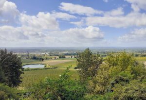
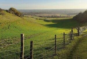
This scenic walk begins in Detling and follows the North Downs Way through woodlands, ridgelines, and open fields, offering sweeping views of the Kent countryside and landmarks like Leeds Castle. The route includes several climbs and descents, passing through White Horse Wood, the Hucking Estate, and eventually descending into the historic village of Hollingbourne. It ends near Hollingbourne Station, with options to relax at local pubs or cafés.
Section 6 – Detling to Hollingbourne
Section 7: Hollingbourne to Lenham (8.5 miles / 13.6km)
The trail begins on Eyhorne Street in Hollingbourne, joining a series of public footpaths that cross fields, stiles, and bridges over the railway and M20. It enters the Leeds Castle estate, passing woodland, a weir, and the golf course, with stunning views of the 12th-century castle. The route continues through woodland and fields to Broomfield village, then follows the Len Valley Walk past farms, orchards, and woodland including Affers Wood and Stream Wood. After passing through Platts Heath and Pleasant Forest, the trail crosses the M20 and railway again, reaching Lenham Heath. It finishes at Lenham Station and The Square in Lenham village, where cafés, pubs, and transport links are available.
Section 7 – Hollingbourne to Lenham