Cuxton rail trail
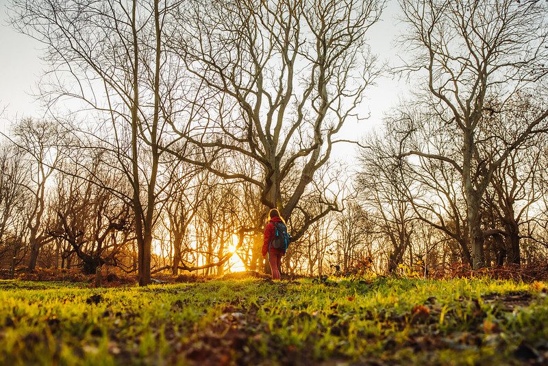
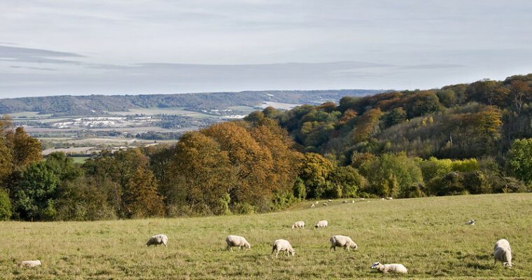
This walk will lead you straight from the hustle and bustle of Cuxton and into Ranscombe Farm, an area within the Kent Downs Area of Outstanding Natural Beauty. You’ll find a classic landscape of woodland, arable fields and grassland here and a rich diversity of wildlife which enjoy a habitat that has changed little since the 18th century.
Glorious views over Bush Valley lie along the trail as well as the orchid-rich chalk grassland of the 57 acre Bockles chalk grassland field. Walking through the fields, look out for wildflowers, fallow deer and ground nesting birds.
In the heart of the woodland you’ll find the Darnley Mausoleum. Built by James Wyatt for the 4th Earl of Darnley in 1783, this imposing structure was built in the neo-classical style for the huge sum of £9,000.
Step by step guide
1. From Cuxton train station follow Station Road to the junction with the main road (Cuxton Road). Cross over Cuxton Road at the traffic lights then turn left into Bush Road to lead you into Cuxton.
2. Just before Cuxton Junior School cross over Bush Road and take the footpath on your right up Tartank Lane. Head uphill and cross over the road you come to (Ladywood Road). Head straight on into White Leaves Rise then take the next left into Poplicans Road.
3. Follow Poplicans Road uphill and before you reach a left hand corner at the top of the hill, take the footpath between house numbers 82 and 86 (it looks like a driveway but soon turns into a footpath). Follow this path for 200 metres until you reach a bridge over the railway. Take this footpath over the bridge into Ranscombe Farm.
4. After crossing over the railway bridge turn left following this path all the way to its end.
5. Continue up the five steps at the end of the footpath which takes you to an open field known as the Brockles. Turn right and follow the footpath around the corner of the field until you reach a crossroads with another path on the corner of the field.
6. Turn right and head downhill across the middle of the next field.
7. When you reach the crossroads in the middle of the field turn left heading to the woodland in front of you. Continue along this footpath into the woodland which takes you round to the left and begins to climb uphill. Take the footpath on your right just before you reach an interpretation board. Follow this path all the way to the Darnley Mausoleum.
8. Go through the gate and walk past the Mausoleum on your left. Follow the main track to the right back into the northern section of Ranscombe Farm. This path is also part of the Ranscombe Farm ‘chestnut trail'. Stay on this main track for approx 1.5km.
9. When you get to the CTRL, turn right down a logging path into an area of coppiced woodland.
10. At the end of this recently coppiced area turn left so the open field is on your right and woodland (Clay Pond Wood) is on your left. Follow the footpath around the edge of the field. Go past a gate and then past another turning along a grassed path on your left. Just before you head uphill you will see a path through woodland (Head Barn Wood) on your left. Follow this path which starts to veer round to the right.
11. On leaving the woodland turn left down the field edge. You will shortly come to a junction with another footpath coming from Strood. Turn right and head up this footpath taking you across the middle of the field away from the motorway. Follow this path for 500 metres then cross the road leading to houses and continue straight on at the crossroads. This path now becomes the North Downs Way.
12. Take the next footpath on your left towards Longhoes Wood leaving the North Downs Way. Follow this downhill into the wooded area and towards the railway line. Take great care crossing over the stile on either side and when crossing the railway line itself. Follow this path to its end and turn right on to the road it joins (Pilgrims Way).
13. Walk downhill where the Pilgrims Way will merge with the pavement alongside the main road. You are heading towards the traffic lights a little further downhill. Cross over Bush Road and then cross over the main road at the traffic lights. Take the next road on the left and follow this back to Cuxton train station.