Aylesford rail trail
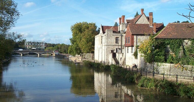
Beginning your walk alongside the river, you’ll be able to admire the striking Carmelite priory across the bank.
You’ll discover plenty of wildlife along this walk, with Kingfishers diving into the river and great crested grebes and a variety of ducks, geese and gulls enjoying the vast lake in the Aylesford sand pit.
The Lower and Greater Culand Pits are another wonder for wildlife. The diggers have long since left these chalk quarries, but today wildlife thrives within these chalk pits.
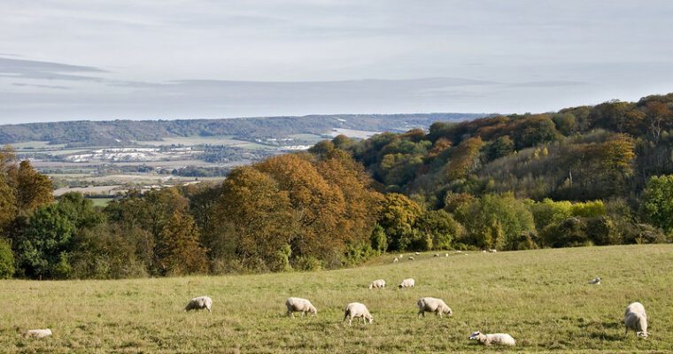
Along the route you’ll spot Kits Coty, a Neolithic burial chamber built nearly 6000 years ago. From here you can enjoy glorious views across the North Downs and the Medway Valley.
Cobtree Manor Park rests at the end of your walk, where you can stroll through the woodland setting and even discover the site of the former Maidstone Zoo!
Step by step guide
1. Turn left out of Aylesford train station then take the next road on your left (Mill Hill) and cross over the train tracks. Continue straight ahead crossing over Friars Way. When you reach the river turn right along the riverside footpath keeping the river on your left hand side.
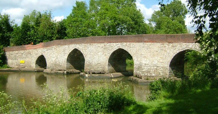
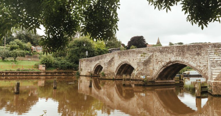
2. At the end of the footpath cross over the 14th century old bridge spanning the River Medway. After the bridge turn right then left across the village square and up Mount Pleasant. Follow this road to the end taking extra care as there is no pavement and the one way road brings traffic towards you.
3. Just before you reach the main road take the footpath on your left alongside a stream. Follow the path with the stream on your right until you reach an open field then turn left uphill.
4. Continue along this path as it turns right and passes through a small woodland (shaw) then a kissing gate. Continue straight on through another kissing gate where you will have the woodland on your right. Follow this path towards the houses and into the village of Eccles along Mackenders Way passing the vines on your right. At the end of Mackenders Way with the junction of the main road (Bull Lane), turn right and follow this for 500 metres.
5. At the end of Bull Lane cross over Pilgrims Way and after 30 metres, turn right up the bridleway directly to the left of the cottage. Take care crossing this busy road as there is no pavement. Follow this path for 1.5 km to its end (which gets quite steep for the last section).
6. Once up the short flight of steps at the end of the bridleway turn right and follow this path downhill. You are now on the North Downs Way which you will follow for just under 2km. Take care here alongside the busy roads.
7. You will come to a North Downs Way sign on your right towards Kit's Coty House. Follow this taking care on the steep steps as you go. After 300 metres you will see a gap in the hedge with Kit's Coty directly in front of you. Continue on the North Downs Way to the road junction at the bottom of the hill.
8. Cross diagonally over the road continuing along the North Downs Way. (There is an option to detour to Little Kit's Coty Neolithic monument here. Head down Rochester Road and after 200 metres you will see a sign on the left to the monument. Take care as there is no pavement along Rochester Road).
9. Continue along the North Downs Way for 500 metres until you reach a junction with the A229 main road (Blue Bell Hill). When you reach this point turn right and then go over the stile to take the next footpath on your right, across an open field towards woodland. You now leave the North Downs Way.
10. Follow the path crossing through the woodland. Turn left after the kissing gate taking you across the field towards another kissing gate. Go through this and straight on to a third kissing gate at the bottom of the field, across a small stream. Follow the path towards the farm houses past the pond on your right. Follow the path (which turns into a driveway) around to the right between the houses.
11. Follow this for 400 metres then take the footpath on your left across a stream and then into Cobtree Manor golf course. Follow the public footpath in a straight line across the fairway heading for a gap in the woodland. Watch out for flying golf balls! Enter the woodland and go straight ahead up the short steep path. You are now in Cobtree Manor Park.
12. Follow the path around to the right which takes you through stunning woodland on the way to the main entrance to the park and car park.
13. Turn right along the main road. After 1km you will come to a junction where you need to turn right towards Aylesford village. Turn left at the mini roundabout and then just after the traffic lights turn left across the old bridge. Turn right after the bridge to follow the riverside path once again back to Aylesford train station.