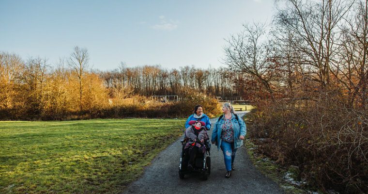
Darnley Trail
The Darnley Trail is a 10km circular route that showcases some of North Kent’s most beautiful and varied landscapes. Linking Shorne Woods Country Park with the rolling countryside beyond the A2, the trail is designed for walkers, cyclists and horse riders, with multiple entry points and shortcuts that make it easy to tailor your adventure.
Beginning at Shorne Woods, a Green Flag award‑winning site with 292 acres of woodland, meadows and wetlands, the trail leads you through peaceful ancient woodland rich in wildlife – from dormice and bats to orchids and dragonflies. As part of the Kent Downs National Landscape and a Site of Special Scientific Interest, it’s a place where nature thrives and visitors of all abilities can enjoy accessible paths and inclusive facilities.
From here, the route opens out into the wider North Kent Woods and Downs National Nature Reserve, a 20km² landscape designated in 2025 as part of The King’s Series. This connected environment brings together landowners, conservation groups and local communities to protect habitats and create space for nature to flourish.
Along the way, you’ll pass through Cobham Park, home to historic Cobham Hall and the striking Darnley Mausoleum, before continuing into Ashenbank Wood, where ancient trees, Bronze Age features and WWII heritage sit quietly among the woodland. The trail also takes in Jeskyns Community Woodland, with orchards, meadows, ponds and imaginative natural play areas — including the popular tree house.
Whether you’re seeking peaceful woodland, wide open meadows, heritage landmarks or family‑friendly spaces, the Darnley Trail offers a rich mix of scenery and experiences. With steep slopes, seasonal mud and shared‑use paths, it’s a route that invites exploration, curiosity and connection with nature.
Step by step guide
1. From Shorne Woods main entrance, cross using the Pegasus crossing and follow the wide track through Brewers Wood. At the crossroads, turn and walk downhill to the boundary at Park Pale Road.
2. Exit through the gate then turn left along Park Pale Road.
3. Take the first left signed for Cobham Golf Course and cross the A2 across Park Pale Bridge.
4. Go under the railway, then turn left through the swing gate. Follow the path between the railway (left) and golf course (right) to the Darnley Trail fork. Take the right fork near the fields.
5. With the fields on your left and woodland on your right, cross the narrow grassland area between two fences, then bear right keeping, the wire fence close on your right.
6. Continue up the steep slope for approx. 300m to the top.
7. At the top, cattle grid on your right,continue straight into denser woodland.
8. Bear right and follow the undulating trail for 800m, fence on your right. Pass three kissing gates, and look right for views of the Darnley Mausoleum. Descend the steep slope and steps, then take the right hand track at the bottom.
9. Continue past a gate and cattle grid. After 650m, pass a beech clearing and keep right by the fence.,Continue past an old quarry on your left.
10. At the kissing gate, do not go through. Turn left into coppice woodland for approx. 300m.
11. Pass through a bridle gate /horse stile, bear right towards the buildings.
12. At the thatched cottage (South Lodge) turn left into Lodge Lane. Follow it for approx. 700m to the War Memorial.
13. Continue straight into Cobham. At ‘Owletts’ turn right up the public byway into Jeskyns Community Woodland. Please note vehicles may be present on this track.
14. To your left in the distance, you can see the tree house and Henhurst Lake with its wooden boardwalk.
15. At the brow of the hill (Hollybush Corner), look left to see two 6m high sculptures marking the highest point of Jeskyns.
16. Near the bottom of the hill, look right to see two mature trees (an Oak and a Sweet Chestnut) framing a view of Ashenbank Wood in the distance.
17. Continue up the track to enter woodland, Chambers Hill Woods to your left and Well Shaw to your right (both privately owned).
18. Cross the railway bridge. At the T junction, turn left and cross the A2 bridge.
19. Pass ‘Inn on the Lake’ and enter Shorne Woods via the metal kissing gate.
20. Follow woodland path uphill. At the junction turn right and continue through ancient woodland.
21. At the next major junction, turn right, then bear left onto the concrete path that’s a remnant of the old clay workings in the Country Park.
22. Turn left and follow the arrows eventually onto a wide surfaced track that will lead you up to the visitor centre, car park and café at Shorne Woods Country Park . Option 2: Turn right and follow the arrows