Lullingstone to Preston Hill Circular Walk
The Lullingstone to Preston Hill Circular Walk is a challenging 7‑mile (11.5km) route that leads you through some of the most dramatic and rewarding landscapes in the Kent Downs National Landscape. Beginning in the peaceful surroundings of Lullingstone Country Park, the trail follows the gentle curves of the River Darent before climbing steeply into ancient woodland and chalk grassland high above the valley.
This is a route designed for experienced walkers who enjoy rugged terrain, steep ascents and long, quiet stretches of countryside. The walk includes slippery slopes, uneven woodland paths and dramatic descents, offering a more demanding adventure for those seeking a deeper connection with nature and a sense of escape.
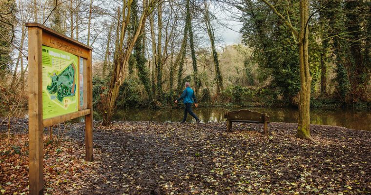
Lullingstone Country Park itself is internationally recognised for its extraordinary collection of over 300 veteran trees – including oak, beech, ash, hornbeam and sweet chestnut, some believed to be up to 800 years old. In spring and summer, the chalk grasslands burst into colour with orchids and wildflowers, creating a vibrant backdrop for wildlife enthusiasts, photographers and anyone who appreciates rich natural heritage. The park also offers excellent facilities, including a café, toilets (with a Changing Places facility), and a classroom supporting learning and Forest School sessions.
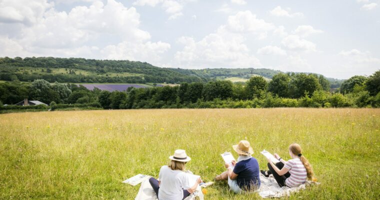
As the route climbs towards Preston Hill, walkers are rewarded with sweeping views across the Darent Valley. This Site of Special Scientific Interest is a striking mix of chalk grassland and woodland, home to chalkhill blue and dark green fritillary butterflies, adders, grass snakes and a grazing herd of Cheviot goats, Britain’s oldest primitive goat breed. The landscape also carries echoes of its past, with remnants of an 18th‑century Ministry of Defence rifle range still visible in the fields.
Step by step guide
1. From the car park, follow the path to the right of the front gate.
2. Go through the kissing gate and follow the surfaced path beside the road with fields on your right, until it meets the road.
3. Go down the steps, cross the road and follow the footpath sign opposite into the fields.
4. Continue straight through the fields until you reach the River Darent on your left..
5. Follow the path with the river on your left and fields on your right until you reach a tarmac road.
6. Turn left onto the road, then take the path to the right in front of the Mill House gates.
7. Cross the bridge, go straight down the steps, and follow the footpath bearing sharply right.
8. Stay on this path, continuing straight at the junction, until you reach the railway crossing.
9. TAKE CARE: Cross the stile, then cross the railway using the pedestrian crossing
10. Continue on the footpath up to the A225 road..
11. TAKE CARE: Turn left and walk along the left-hand verge for approximately 70m. Cross the road and take the footpath into the field. There is a small paved area where the footpath meets the road.
12. Head diagonally across the field and stay on the footpath into woodland.
13. Follow the path through the wood, cross a tarmac drive, then follow the path up into the woods.
14. TAKE CARE: This section of path is a very steep climb and can be very slippery when wet
15. Near the top, you will pass the old flagpole on your left, once used to signal when the Preston Hill rifle range was active.
16. At the top, bear left and follow the path into Preston Hill, a Site of Special Scientific Interest.
17. Continue to a junction with a track opposite an open field. Turn left down the track, then right at the next junction.
18. Go through the kissing gate and follow the path with the field on your right.
19. At the next junction, bear left slightly downhill and follow the path through yew and coppice woodland until you reach the end.
20. Bear left and stay on the path as it goes downhill to the chalk grassland field.
21. Go through the kissing gate into the field. This viewpoint offers excellent views across the Darent Valley.
22. Head downhill through the field and turn left just before a noticeboard.
23. Follow the path to the fence and pass through a kissing gate into woodland. Continue to the next kissing gate, with the railway cutting on your right.
24. Go through the kissing gate into the field and continue straight ahead, keeping with the railway line on your right hand side.
25. At the track, turn left and go through the kissing gate. Follow the track to the field entrance.
26. At the top of the track, bear right and go through the kissing gate into Rifle Range Field. This field contains firing points and old target structures from an 18th century rifle range. The white pole ahead marks the former target location.
27. Turn right through the first kissing gate on your right and follow the path gently uphill.
28. Turn right at the junction and follow the path to the track. Go through the kissing gate and turn left.
29. Follow the track uphill through woodland and take the first path on the right at the top of the hill, just before the open fields.
30. You now retrace your steps back the Country Park car park.